The Cézallier gateway
Add to my favorites

Route opened
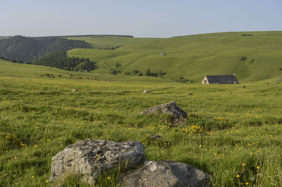
A 2-day hike to discover the churches of Chalinargues and Allanche, the ramparts, the Pinatelle forest and the view of the Cantal and Cézallier mountains from the Roche Grande summit.
The characteristics of the route.

Allanche (15)
- Distance 32.8 km
- Elevation gain 710 m
- Elevation lost 710 m
- Min. elevation 945 m
- Max. elevation. 1194 m
- Duration (depending on pace) 9h
- Marking Yes
Marking : WE 1.Equipments : Picnic area, Car park, Free car park, Good plans : -For your safety, please check the weather forecast before setting off on your hike. -To preserve the environment in which you are located, please avoid leaving garbage in nature. -Remember to take the appropriate equipment for the weather conditions and the hiking itinerary (hiking boots, water bottle, cap, sunglasses, jacket...).Admission fee : Free access.Opening : All year round.
Subject to favorable weather.
Report a problem Add a comment
Website Pdf file
Add your time and share your feelings
Services nearby

Nature Moments
Neussargues en Pinatelle

Stopover-gite - Bed and Nature
Neussargues en Pinatelle
Equestrian centre in the Pinatelle
Neussargues en Pinatelle
La Grange des Huskies
Neussargues en Pinatelle
Natur'O'Col - Les Traîneaux de la Roche du Pic
Neussargues en Pinatelle


Information updated on 2023-10-17 by Hautes Terres Tourisme


Contact Carladès area
Carladès Tourist Office
Avenue A. Mercier
15800 Vic-sur-Cère
Tel. 04.71.47.50.68
Carladès Tourisme
tourisme@carlades.fr
![]()
Contact Hautes Terres area
Hautes Terres Tourist Office
Pl. Hôtel de ville - 15300 Murat
Tel. 04.71.20.09.47
Hautes Terres Tourisme
contact@hautesterrestourisme.fr
@hautesterrestourisme
@hautesterrestourisme


OK
Annuler